EMIT for lithological mapping
Mapping surface minerology in Arabian-Nubian Shields using imaging spectroscopy
Grant Title: EMIT for Lithologic Mapping, Mineral Exploration, and Tectonic Investigations in Arid Lands
Funding Agency: NASA
Grant Number: 80NSSC24K0863
Period: 2024 – 2027
Abstract:
We are evaluating the lithologic mapping capabilities of EMIT, their application for identifying mineralization in arid and hyperarid crystalline terrains, and their potential contribution to understanding the accretionary and post-accretionary history of Nubian Arabian Shields.
See full abstract and the team at NASA project webpage
Products:
SpectralViewer web application
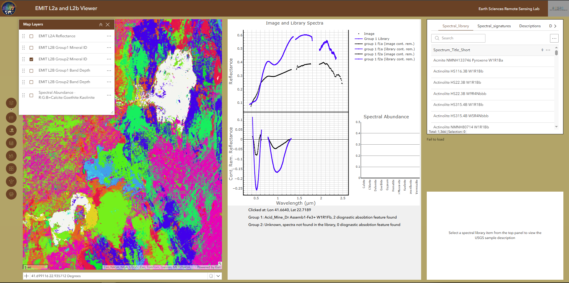
A web application for visualizing and analyzing NASA’s EMIT surface reflectance and mineralogy data, accessible at https://www.esrs.wmich.edu/webmap/SpectralViewer/ or https://www.esrs.wmich.edu/webmap/EMIT_viewer/
AGU 2025 Abstract: We present a new web application that supports interactive visualization and analysis of NASA’s EMIT (Earth Surface Mineral Dust Source Investigation) hyperspectral surface reflectance and mineralogy data. The tool enables users to explore EMIT Level 2A reflectance and L2B mineral identification products, along with the spectral abundance of 10 EMIT minerals. It incorporates the USGS reference spectral library and diagnostic absorption features as defined by the Tetracorder expert system. Users can click on map locations to retrieve and plot observed reflectance, compare it with library spectra, and analyze diagnostic absorption features of identified materials using the continuum removal technique. The application provides dual spectral plots (reflectance and continuum-removed reflectance), mineral abundance bar charts, and detailed information panels, making it a valuable resource for both scientific research and educational outreach. It also allows downloading interactive plots for offline use. To improve geological context, the application integrates regional geological maps, digital elevation models (DEMs), drainage networks, and locations of known critical mineral occurrences. These additional data layers support more comprehensive analysis and interpretation of the EMIT-derived mineralogy and its potential for mineral exploration. This platform simplifies access to EMIT data, enhances mineralogical interpretation, and facilitates reproducible geospatial analysis for the imaging spectroscopy and mineral exploration communities. Currently, data coverage extends from the Nubian Arabian Shield in the West, across the Arabian Peninsula, to the Zagros Mountains in the East. The application is publicly accessible and designed to be adaptable for other hyperspectral sensors.
